
When the Sky Turns Dangerous: Why Ohio Organizations Are Deploying Professional Weather Stations to Protect Lives


Ohio Weather Is Uniquely Varied — And Emergency Managers Know It
Ohio sits at a crossroads of weather systems. The same state that has produced some of the most violent tornadoes in American history also faces river flooding along the Great Miami and Ohio Rivers, derecho-force straight-line wind events that can rival hurricanes in their power outage footprint, and lake-effect snow squalls off Lake Erie that can drop feet of snow in hours. Ohio’s mix of dense urban centers, industrial and manufacturing corridors, and river valley geography means a single severe weather event can simultaneously threaten public safety, critical infrastructure, and regional supply chains.
The record is well documented. The 1913 Great Dayton Flood remains Ohio’s worst natural disaster, killing an estimated 360 or more people statewide and displacing 65,000 residents after the Great Miami River overwhelmed the city’s levees. On April 3, 1974, an F5 tornado tore through Xenia during the historic Super Outbreak, killing at least 32 people in Xenia alone and contributing to 38 direct deaths statewide. On May 27, 2019, a Memorial Day tornado outbreak sent 21 tornadoes across Ohio, including an EF4 that struck Dayton and Trotwood overnight, causing $500 million in damage and becoming the fourth-costliest weather event in Ohio history. And on June 29, 2012, a derecho — a fast-moving band of destructive straight-line winds — swept across Ohio during a record heat wave, knocking out power to more than a million Ohio customers for up to a week and contributing to heat-related deaths in homes left without air conditioning.
For the professionals responsible for protecting Ohio communities, the challenge is not awareness of these risks — it is having the right data, at the right location, at the right moment to act decisively. National Weather Service alerts are a critical layer of warning, but they are county-scale and often lag conditions on the ground by minutes that matter, particularly for fast-forming nighttime tornadoes and derechos that can outrun a forecast. What many Ohio organizations are discovering is that deploying a professional weather station on-site — a multi-sensor device providing real-time, facility-level readings — is the missing link between a regional forecast and a life-safety decision at a specific facility, field site, or outdoor venue.
Ohio Weather by the Numbers
1913 Great Dayton Flood: an estimated 360+ deaths statewide, 65,000 displaced — Ohio’s worst natural disaster
April 1974 Xenia F5 tornado: at least 32 deaths in Xenia, 38 direct deaths statewide during the Super Outbreak
May 2019 Memorial Day tornado outbreak: 21 tornadoes statewide, an EF4 through Dayton/Trotwood, $500 million in damage
June 2012 derecho: over 1 million Ohio customers lost power, some for up to a week during a record heat wave
Northern Ohio faces lake-effect snow squalls off Lake Erie capable of dropping feet of snow in a matter of hours
Ohio’s risk profile spans tornadoes, derechos, river flooding, lake-effect snow, and extreme heat — often affecting dense urban and industrial corridors
What cyclonePORT Monitors — and Why Each Sensor Matters for Emergency Response
Wind Speed & Direction
Wind data is foundational to emergency management across threat types. Ohio’s history includes both violent tornadoes, like the F5 that struck Xenia in 1974, and derechos — the June 2012 event produced sustained damaging winds over hundreds of miles. Rapid ground-level wind acceleration monitored by cyclonePORT can provide critical seconds of additional warning for tornado formation, while sustained wind readings help utilities, logistics operations, and emergency managers track a derecho’s approach and passage at a specific facility. In northern Ohio, wind direction data also informs lake-effect snow band positioning near Lake Erie.
Ohio’s humid continental climate produces frequent severe thunderstorm activity in spring and summer, and lightning is particularly dangerous for outdoor events, athletic facilities, utility crews, and emergency staging areas. cyclonePORT’s lightning detection sensor identifies strike activity in real time, enabling organizations to implement lightning safety protocols — clearing outdoor areas, suspending operations, sheltering personnel — before a strike becomes a fatality. The Ohio High School Athletic Association (OHSAA) specifically directs schools to monitor local weather conditions before and during outdoor practices and contests, making lightning detection a practical tool for meeting that expectation.
Rain Gauge
Rainfall accumulation data from cyclonePORT is directly relevant to river and flash flood risk — the hazard responsible for the 1913 Great Dayton Flood, still Ohio’s worst natural disaster more than a century later. The Great Miami and Ohio River valleys, along with numerous smaller watersheds across the state, remain vulnerable to rapid rises during heavy rainfall. A cyclonePORT rain gauge provides site-specific accumulation data that, combined with NWS flash flood guidance, gives emergency managers actionable information for road closures, evacuation decisions, and infrastructure protection at a specific facility or community.
Rapidly dropping barometric pressure is one of the earliest measurable precursors to severe weather intensification. Ahead of the kind of squall lines that produce derechos and supercell thunderstorms — systems responsible for some of Ohio’s worst tornado outbreaks — pressure trends monitored by cyclonePORT give operations centers additional lead time to activate protocols and notify personnel before severe weather arrives, including during the overnight hours when Ohio has repeatedly seen its most destructive tornadoes strike.
Humidity Sensor
Relative humidity intersects with emergency response in two critical ways in Ohio. At high temperatures, elevated humidity dramatically increases effective heat stress — the heat index — which determines the risk of heat-related illness for outdoor workers, first responders in full gear, and vulnerable populations. This risk compounds sharply during power-outage events: many of the heat-related deaths following the 2012 derecho occurred in homes without air conditioning during the outage that followed. cyclonePORT’s humidity data, combined with temperature readings, provides the inputs needed to calculate real-time heat index values for a specific location, including during grid disruptions when regional weather data may be harder to access.
Wet Bulb Globe Temperature (WBGT)
WBGT is the gold standard metric for evaluating heat stress risk in occupational and athletic settings. Unlike heat index, WBGT accounts for solar radiation load, making it significantly more accurate for outdoor environments where workers or student-athletes are exposed to direct sun. OHSAA guidance recommends halting all outdoor athletic activity once WBGT reaches approximately 89.8°F, with readings taken at least every 30 minutes during outdoor practice. Ohio school districts, municipalities, and private-sector employers with outdoor workforces increasingly rely on WBGT data to manage heat safety decisions in a documented, defensible way.
Ohio-Specific Use Cases: cyclonePORT in Emergency Management Practice
Tornado Preparedness in the Miami Valley and Beyond
Ohio has produced some of the most violent tornadoes in U.S. history, from the F5 that leveled much of Xenia in 1974 to the EF4 that tore through Dayton and Trotwood overnight on Memorial Day 2019. The 2019 event demonstrated both the value and the limits of regional warning systems: the National Weather Service office in Wilmington issued warnings with strong lead time, yet the tornado still caused catastrophic damage and 166 injuries. For emergency managers overseeing outdoor facilities, large campuses, or distributed operations across Ohio’s tornado-prone regions, cyclonePORT provides site-level wind and pressure data that complements storm spotter networks and NWS warnings, including during overnight hours when human observation is limited.
When a tornado watch is issued, wind speed and pressure readings from cyclonePORT allow facility operators and incident managers to monitor real-time surface conditions and make timely shelter-in-place decisions. After a tornado event, cyclonePORT’s sensor logs provide documented weather data for after-action reviews and insurance documentation.
Case Application: School District Heat Safety Decisions
OHSAA recommends that all outdoor athletic activity stop once WBGT reaches approximately 89.8°F, with readings taken at least every 30 minutes during practice — but this guidance is a recommendation rather than a strict mandate, leaving the specific decision to each district. A cyclonePORT station installed at an athletic facility gives athletic trainers and administrators continuous, on-site WBGT readings, allowing them to make objective, well-documented decisions about practice modifications and cancellations rather than relying on a single handheld reading or a nearby airport’s weather data.
Derecho and Severe Wind Event Response
The June 2012 derecho that swept across Ohio during a record heat wave demonstrated how a fast-moving, region-wide wind event can compound into a public health emergency. Ohio saw over a million customers lose power, with some outages lasting up to a week during triple-digit heat — a combination that contributed to heat-related deaths in homes without air conditioning. For utilities, county emergency managers, and facilities operators, cyclonePORT wind and pressure data provides advance warning of an approaching squall line and real-time tracking of wind speeds as the event passes through a specific location.
After a derecho or major wind event, cyclonePORT’s continuous sensor logs help utilities and emergency managers document the timeline of the event for outage prioritization, insurance claims, and public communication about recovery timelines.
River Flooding in the Great Miami and Ohio River Valleys
More than a century after the Great Dayton Flood, Ohio’s river valleys remain vulnerable to rapid rises during periods of heavy rainfall, even with the flood-control infrastructure built by the Miami Conservancy District and similar agencies in the flood’s aftermath. County emergency managers and municipal public works departments use rainfall accumulation data to make real-time decisions about road closures, floodgate operations, and evacuation warnings.
A cyclonePORT station positioned at a flood-prone facility or low-lying community provides site-specific accumulation data that supports these decisions, giving emergency managers the early quantitative signal needed to act before floodwaters rise and before residents and infrastructure are at risk.
Lake-Effect Snow and Winter Weather Operations in Northern Ohio
Communities along Ohio’s Lake Erie shoreline — including the Cleveland, Toledo, and Ashtabula areas — face lake-effect snow squalls that can drop several feet of snow in a highly localized band within hours, often with limited advance notice compared to synoptic-scale winter storms. Wind direction is the single most important variable in determining where a lake-effect band will set up and how long it will persist over a given community.
Real-time wind direction, temperature, and humidity readings from cyclonePORT help transportation departments, school districts, and emergency managers in Ohio’s Snowbelt anticipate band positioning and duration at a specific location, supporting decisions about school delays, road treatment staging, and public communication during fast-developing lake-effect events.
Heat Emergency Response and Outdoor Worker Safety
Ohio’s urban centers — Columbus, Cleveland, Cincinnati, Dayton, and Toledo — all experience meaningful urban heat island effects, and heat risk increases sharply during power outages, as the aftermath of the 2012 derecho demonstrated. For emergency managers overseeing cooling center operations, outdoor event safety, or utility and construction worker welfare programs, real-time heat index and WBGT data from cyclonePORT is a direct operational input.
Counties operating heat emergency programs use weather station data to trigger cooling center activations. Municipalities managing outdoor events use WBGT thresholds to determine whether to modify, delay, or cancel activities. Employers in construction, manufacturing, and logistics use cyclonePORT data to support workplace heat safety practices under the federal OSHA General Duty Clause, which applies to private-sector employers in Ohio.
Regulatory Compliance: Weather Monitoring as an Operational Obligation
For many Ohio organizations, the question is not simply whether cyclonePORT is useful — it is whether documented, on-site weather monitoring supports obligations that already exist. The regulatory landscape increasingly suggests that organizations operating outdoor facilities or managing outdoor workforces have responsibilities that on-site monitoring directly supports.
Federal OSHA, PERRP, and Workplace Heat Safety
Ohio’s occupational safety framework is a hybrid one. Ohio is not an OSHA-approved state plan, so private-sector employers fall under direct federal OSHA jurisdiction, including the General Duty Clause that has been applied in heat-related fatality investigations where employers failed to monitor environmental conditions. Public-sector employees, meanwhile, are covered not by federal OSHA but by Ohio’s own Public Employment Risk Reduction Program (PERRP), a state-law construct under Ohio Revised Code Chapter 4167 administered through the Ohio Bureau of Workers’ Compensation, which incorporates federal OSHA standards by reference. Whichever framework applies, having a cyclonePORT station with WBGT measurement creates a documented, objective record of conditions at a worksite that supports both proactive decision-making and post-incident compliance defense.
OHSAA Athletic Safety Guidance
OHSAA directs member schools to monitor WBGT or an equivalent measure before and during outdoor practices and contests, with a recommended threshold of approximately 89.8°F for halting outdoor activity entirely. Because this guidance is a recommendation rather than a strict statewide mandate, individual districts carry significant discretion — and therefore significant responsibility — for their own heat safety decisions. School districts that document weather-based activity decisions using on-site station data are in a stronger position to defend those decisions than those relying on a single handheld reading or a distant airport’s conditions.
Ohio EPA and Industrial Facilities
Industrial facilities operating under Ohio EPA Division of Air Pollution Control permits routinely need meteorological data to support air dispersion modeling required for permit applications — Ohio EPA itself maintains and distributes preprocessed meteorological datasets for this purpose. Facilities with their own on-site cyclonePORT station gain continuous, site-specific meteorological data that can support both compliance documentation and emergency response planning tied to their air permit obligations.
FEMA and Ohio EMA Documentation
Following a federally declared disaster in Ohio, documented weather data from an on-site station strengthens FEMA Public Assistance and Hazard Mitigation Grant Program applications. The Ohio Emergency Management Agency, established under Ohio Revised Code Chapter 5502, coordinates the state’s emergency management activities and works closely with county-level emergency management agencies that benefit from having a timestamped sensor record of the weather event that triggered response costs or facility damage.
Built for Severe Weather
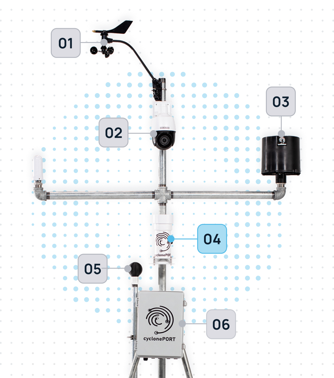
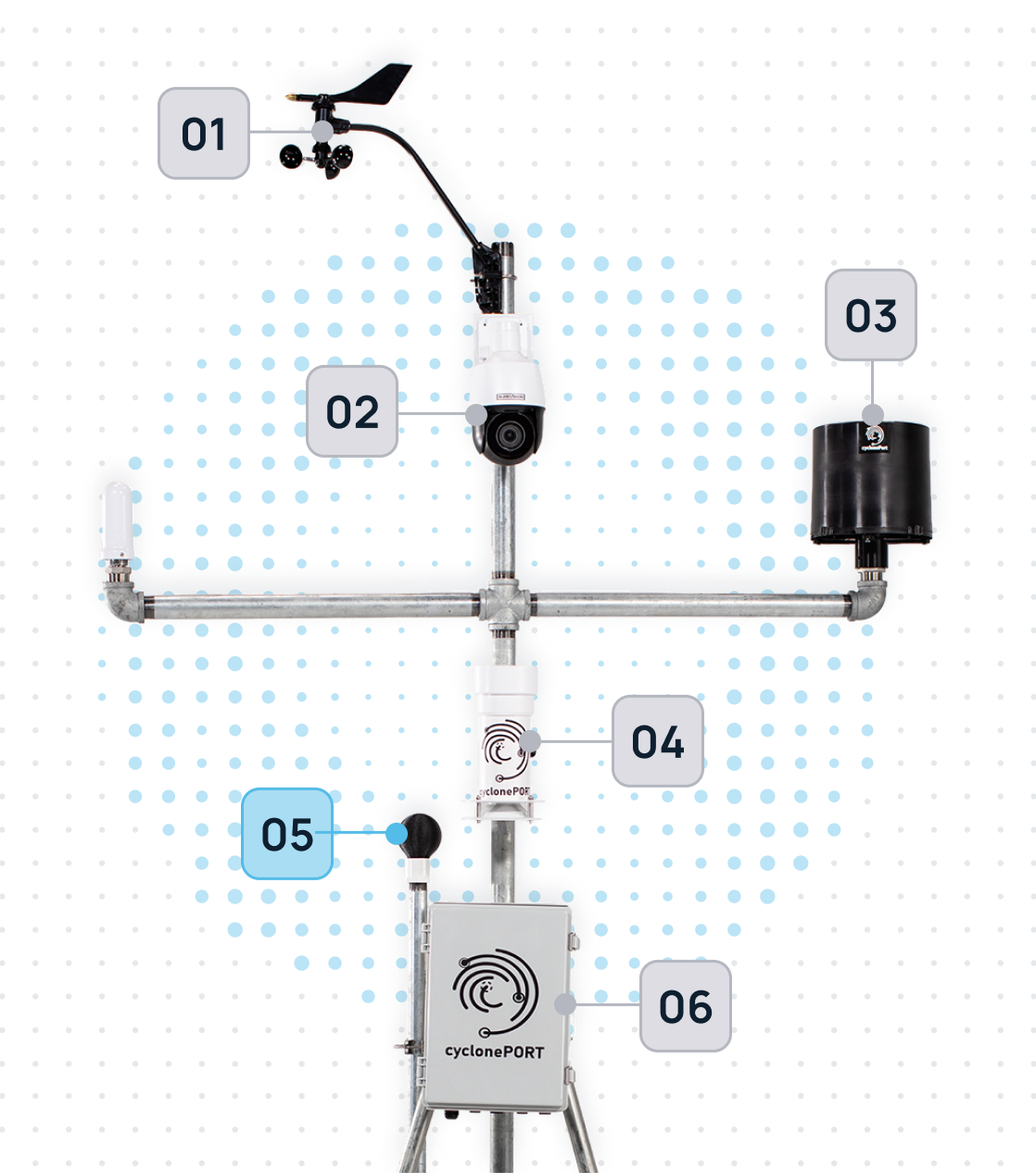
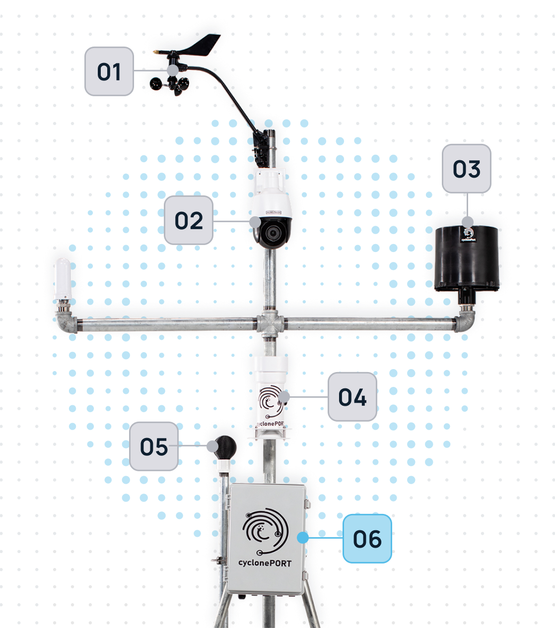
The Pulse of the Sky
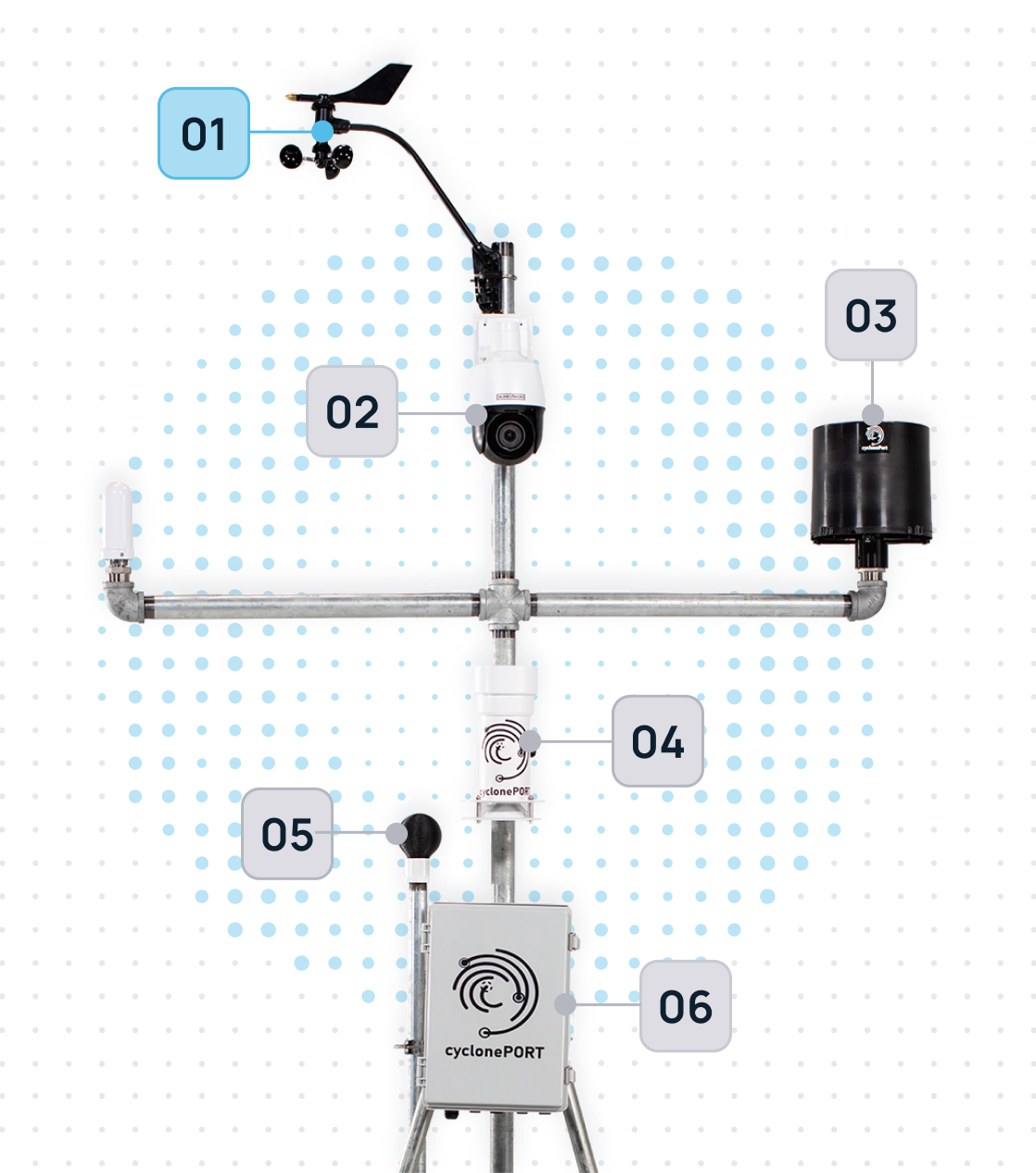
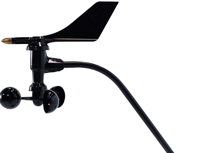
The anemometer is the “nervous system” of our weather stations. Moving beyond old-fashioned mechanical cups, our hardware utilizes ultrasonic sensor arrays to measure the velocity and direction of the wind. By calculating the time it takes for sound pulses to travel between sensors, it provides a lag-free, high-definition map of air movement.
The PTZ Observation Unit
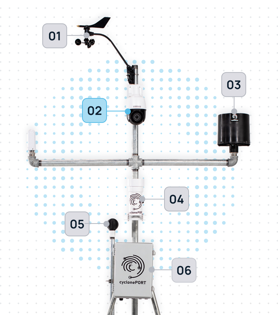
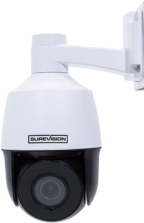
Our PTZ units are ruggedized optical sensors designed to withstand the very conditions they are monitoring. These aren’t just for recording video; they serve as a critical layer of visual ground-truthing. When our sensors detect a change in wind speed or pressure, the PTZ camera can automatically swivel to the point of interest—allowing us to see the formation of wall clouds, debris, or precipitation in real-time.
The lens moves vertically, allowing for a look at both high-altitude cloud formations and ground-level impacts
Liquid Precision: The Smart Rain Gauge
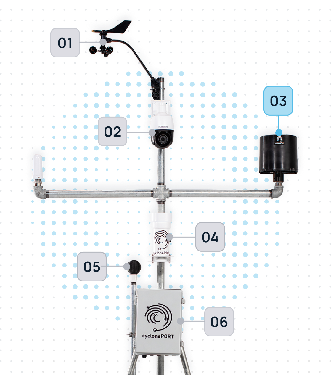
The rain gauge is the primary component for measuring precipitation intensity and accumulation. Our systems typically utilize “Tipping Bucket” or “Optical” technology to provide high-resolution data. As droplets enter the collector, the sensor logs the volume in real-time, allowing our AI to calculate rainfall rates per minute.
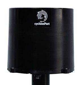
Resilience by Design: The Primary Sensor Housing
The Primary Sensor Housing is the ruggedized enclosure that integrates and protects the suite of meteorological instruments. It isn’t just a box; it is a precision-engineered environment. Designed with aerodynamic stability and thermal regulation, it ensures that internal components—like barometers, data loggers, and transmission hardware—stay dry, cool, and connected even in hurricane-force winds or sub-zero blizzards.
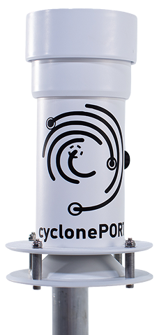
Human-Centric Heat Intelligence
The Wet Bulb Globe is the “biometric” sensor of our weather stations. It doesn’t just measure ambient air; it accounts for the three-way punch of temperature, humidity, and solar radiation. By simulating how a human being absorbs heat while sweating in direct sunlight, it provides the Wet Bulb Globe Temperature (WBGT)—the most accurate metric for predicting heat exhaustion and sunstroke.
For companies managing outdoor crews, sports events, or high-load data centers, this sensor is the definitive “go/no-go” signal for safety.
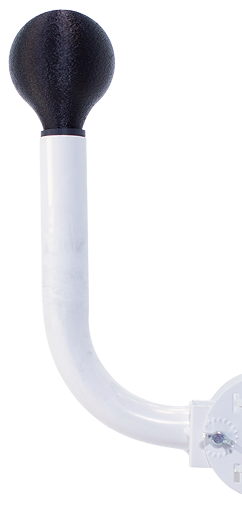
The Intelligence Engine: CyclonePORT Hub
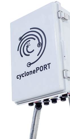
The CyclonePORT Hub is the central nervous system of our weather monitoring architecture. It serves as the high-speed bridge between raw environmental data and actionable cloud intelligence. While our sensors are busy “feeling” the storm, the Hub is busy translating those signals, encrypting the data, and ensuring it reaches our forecasting models in milliseconds—even when local power grids or traditional networks fail.
It is designed for “Edge Computing,” meaning it processes critical data locally to provide instant alerts before the information even hits the cloud.
Deployment Profiles: Where Ohio Organizations Are Installing cyclonePORT
cyclonePORT is designed for professional and commercial use across a wide range of organizational settings. Ohio emergency managers are deploying cyclonePORT weather stations in configurations that match their specific risk profiles and operational requirements.
Organization Type | Primary cyclonePORT Use Cases |
County Emergency Management Agencies | Real-time surface weather for EOC situational awareness; overnight tornado and derecho monitoring; documentation for disaster declarations and Ohio EMA reporting |
K–12 School Districts | WBGT-based outdoor athletic safety decisions under OHSAA guidance; lightning detection for campus grounds; winter weather and lake-effect snow monitoring for delay decisions |
Municipal Parks & Recreation | Lightning detection for aquatic centers and athletic fields; heat index monitoring for outdoor events; rainfall data for river and greenway closures |
Electric Utilities & Cooperatives | Wind and pressure monitoring at substations and generation facilities; derecho and severe storm outage-risk forecasting; storm documentation for regulatory and insurance purposes |
Manufacturing & Logistics Operations | Site weather monitoring for distribution centers and plants across Ohio’s freight corridors; heat compliance for warehouse and yard crews under PERRP or federal OSHA; wind and lightning data for outdoor loading operations |
Construction & Infrastructure Contractors | Heat safety documentation supporting federal OSHA General Duty Clause compliance; lightning safety for elevated work; wind monitoring for crane and lift operations |
Hospitals & Healthcare Campuses | Weather monitoring for emergency preparedness compliance; heat and cold weather protocols for patient transport and outdoor staff; backup sensor for facility resilience planning during outages |
Lake Erie Shoreline Communities & Ports | Wind direction monitoring for lake-effect snow band positioning; lightning detection for outdoor terminal and marina operations; storm documentation for port and shipping insurance |
Integration with Ohio Emergency Management Systems
Compatibility with NWS Alert Workflows
National Weather Service offices serving Ohio — including Wilmington, Cleveland, and Northern Indiana — issue Tornado Warnings, Flash Flood Warnings, Severe Thunderstorm Warnings, Lake Effect Snow Warnings, and Extreme Heat Advisories that establish the regional threat context. cyclonePORT provides the site-specific surface data that gives those alerts operational meaning for a particular location. When an NWS Tornado Warning is issued overnight, a cyclonePORT station provides continuous wind and pressure readings at a specific facility without requiring visual confirmation.Backup Monitoring During Grid and Communication Events
The June 2012 derecho and the 2019 Memorial Day tornado outbreak both demonstrated that Ohio emergency managers must plan for scenarios where standard communication and power infrastructure is degraded across large geographic areas. cyclonePORT hardware is designed for resilient deployment, providing organizations with a monitoring capability that does not depend on the continuity of broader infrastructure systems.Documentation for After-Action Reports and Grant Applications
Timestamped sensor logs from cyclonePORT provide the kind of granular, location-specific weather record that supports after-action reviews, insurance claims, FEMA documentation, and grant narrative development. For Ohio county emergency managers writing Hazard Mitigation Grant Program applications, documented local weather event data strengthens the case for infrastructure investment.Frequently Asked Questions: cyclonePORT for Ohio Emergency Management
Which weather threats in Ohio are most relevant to cyclonePORT’s sensor suite?
How does cyclonePORT fit into an existing emergency management weather monitoring workflow?
Does our organization have a regulatory obligation to monitor on-site weather conditions?
Can cyclonePORT support a multi-site or distributed deployment across our facilities?
How does cyclonePORT data integrate with existing EOC tools and notification systems?
What are the data retention capabilities for weather records — for insurance, compliance, or grant documentation?
Conclusion: Ground Truth for Ohio Emergency Management
Ohio emergency management professionals face one of the most structurally varied threat environments in the country — protecting dense urban centers, major manufacturing and logistics corridors, and river valley communities from tornadoes, derechos, floods, and lake-effect snow, often within the same year. The tools available to support their work have never been more capable. cyclonePORT is a professional weather station that represents a practical, deployable extension of the warning and monitoring ecosystem, giving organizations the ground-level data they need to make faster, more defensible decisions when weather turns dangerous.
From the tornado risk of the Miami Valley to the derecho vulnerability of the state’s power grid, from the river flooding history of the Great Miami watershed to the lake-effect snow bands along Lake Erie, the need for real-time, on-site weather intelligence is not abstract. It is operational. It is happening right now, in the communities and facilities that Ohio emergency managers are responsible for protecting.
Build the Hyper-Local Weather Intelligence
Your Ohio EOC Needs
Contact the SDS Weather team to learn more about cyclonePORT, discuss your organization’s specific weather monitoring needs, and explore deployment options for your facilities and operations.
cycloneport.com/contact | info@cycloneport.com | 844-737-9328